
Antarctic Ozone Hole
Ozone (O₃) is a molecule composed of three oxygen atoms. It plays a crucial role in Earth’s atmosphere by absorbing parts of the sun’s ultraviolet (UV) radiation. Ozone forms a layer in the stratosphere, protecting life on Earth from the impact of UV radiation such as skin cancer, cataracts, and other biological damage. In the 1980s, scientists discovered a seasonal depletion of ozone over Antarctica—a phenomenon known as the Antarctic ozone hole.
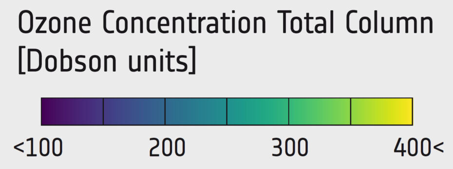
The Antarctic ozone hole forms each spring in the Southern Hemisphere (August to October), when ozone concentrations over the region drop dramatically (while there is no real “hole” in the atmosphere, this term is used for areas with an ozone concentration below 200 Dobson units). This depletion is largely due to human-made chemicals called chlorofluorocarbons (CFCs), previously used in refrigerants, aerosol sprays, and solvents. When CFCs reach the stratosphere, UV radiation breaks them down, releasing chlorine atoms that react with ozone molecules, destroying them in a chemical process. The extreme cold temperatures over Antarctica further exacerbate this process by forming stratospheric clouds, which provide surfaces for chemical reactions that accelerate ozone depletion.
In 1987, an international agreement to phase out ozone-depleting substances was made (Montreal Protocol), leading to a significant decrease of the use of CFCs and other ozone-harming chemicals. Due to their long atmospheric lifetimes, these substances continue to influence ozone levels, and the Antarctic ozone hole remains a recurring phenomenon. A gradual decrease in the severity of the ozone hole was observed since the late 1990s, indicating a slow but steady recovery, even though this is not a smooth process.
Satellites are important tools for monitoring ozone levels and the Antarctic ozone hole. They provide valuable data on atmospheric composition, enabling scientists to track changes in ozone levels, understand the dynamics of ozone depletion, and assess the effectiveness of global environmental policies.
In this important field, contributions of ESA satellites include missions such as Envisat (2002-2012), MetOp (since 2006), Sentinel-5P (since 2017), and planned missions like Sentinel-5.
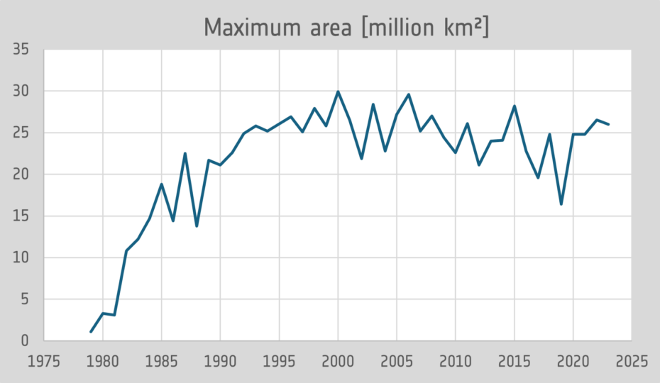
Development of the maximum area of the Antarctic ozone hole (source: NASA Ozone Watch 2024).
Exercises
- Satellite Maps:
- Have a look at the satellite maps showing the development of the ozone concentration in October over Antarctica between 1970 and 2020. Which differences can you identify?
- Looking at the map of the ozone concentrations, where can you find the lowest concentrations? What might be the reason? Think about the temperature and its role for the formation of clouds.
- Look at the diagram below showing the development of the maximum ozone hole area and describe the development, taking the year of the Montreal Protocol into account.
Links and Sources
| Downloads: | |
| PDF document of the case study (includes exercises): English, German, French, Italian, Spanish |
|
|
|
This case study is covered on pages 54-55 of the printed ESA Schoolatlas – download the PDF document of the page: English, German, French, Italian, Spanish |
| Links: |
|