
Coastal Nature Protection
The Bissagos Islands, part of Guinea-Bissau in West Africa, encompass several national parks, with Orango National Park and Bissagos Archipelago National Park being the most prominent. Orango National Park spans approximately 14,000 hectares, providing a sanctuary for endangered species such as manatees and various migratory birds. This park is particularly notable for its mangrove ecosystems and habitats that support rich marine life.
The Bissagos Archipelago National Park, covering around 18,000 hectares, features a mosaic of wetlands, mangroves, and marine areas, making it essential for both biodiversity conservation and local fisheries. These protected areas are integral to the ecological health of the region, serving as breeding grounds for fish and nesting sites for birds.
Like other nature protection areas in the world, the national parks face significant challenges. Illegal fishing, deforestation, and climate change pose threats to the balance of these ecosystems. Overfishing depletes fish stocks, which are crucial for local communities and the broader marine environment. Additionally, rising sea levels and increased salinity threaten mangrove habitats, crucial for coastal protection and biodiversity.
To address these issues, the use of satellite data has become increasingly important. Remote sensing technology allows for the monitoring of environmental changes, enabling park authorities to track deforestation rates and the health of mangrove forests. Conservationists can identify hotspots of illegal activities and respond more effectively. For instance, monitoring land use changes helps in implementing targeted conservation strategies and enforcing regulations.
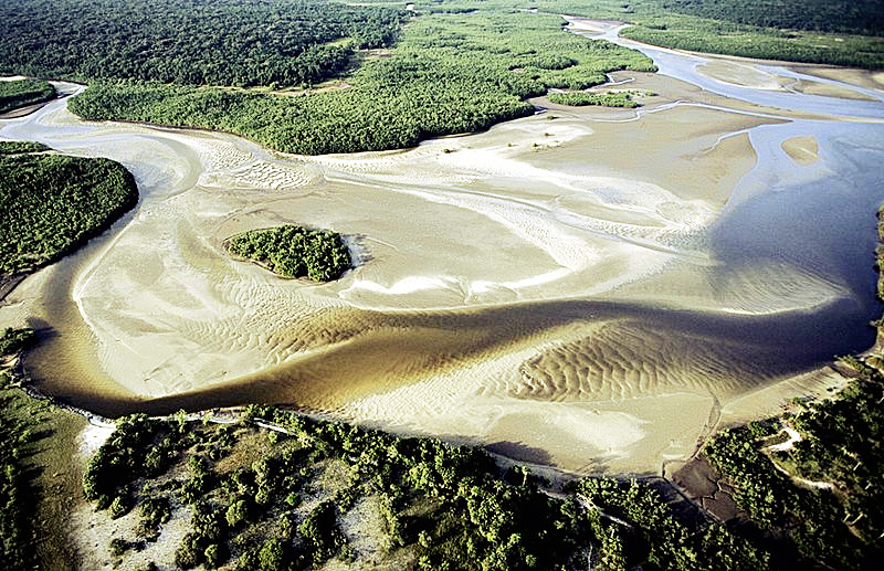
Aerial view of a mud plain in the Bissagos Archipelago during ebb tide (photograph: Powell.Ramsar)
Exercises
- Satellite Map:
- Look at the overview satellite image maps and try to estimate the area covered by aquaculture.
- Which other types of land cover and landuse can you identify?
- Look at the colour of the sea in the Bohai Bay. What does it tell about the sediment concentration of the water?
- Deselect all satellite images except the one from 1989 and zoom to the area covered by the image. Which land cover classes can you identify?
- Add the satellite images from 1989, 1997, 2007, 2010, and 2023 one by one and describe the changes. Are the aquaculture installations extending on land surfaces only?
- How can these landuse changes influence the wildlife in this region?
- How do they affect the people living there?
- Copernicus Browser:
- Open the Copernicus Browser.
- Find the most recent Sentinel-2 dataset covering the area displayed in the satellite map. Is it easy to find cloud-free images? If not, what could be the reason? Think about the climate zone of the region!
- Select a true colour visualisation.
- Can you identify additional, recent changes in the area (check especially the coastal region?
- Select the false colour infrared representation. Can you identify the land-use of the most intensely vegetated areas (represented by bright red colours)?
- Have a look to the coastal regions. Can you identify whether the image shows an ebb tide or a flood tide situation?
Links and Sources
| Downloads: | |
|
PDF document of the case study (includes exercises): English, German, French, Italian, Spanish |
|
|
|
This case study is covered on page 67 of the printed ESA Schoolatlas – download the PDF document of the page: English, German, French, Italian, Spanish |
| Links: |
|