
Oceanic Energy Redistribution
The Gulf Stream and the North Atlantic Current are important components of the global ocean circulation system and influence the climate of Europe and beyond. The Gulf Stream is a warm current that originates in the Gulf of Mexico and flows northward along the eastern coast of the United States before heading towards northeast into the Atlantic Ocean. As it moves further north, it transitions into the North Atlantic Current, which carries warm water across the Atlantic toward northern Europe.
The Gulf Stream transports a significant amount of heat from the tropics to higher latitudes. When it reaches the North Atlantic, a part of it forms the North Atlantic Current. This current flows northeastward, warming the coasts of western and northern Europe, including the British Isles, Scandinavia, and even parts of the Arctic.
The Gulf Stream and the North Atlantic Current are largely responsible for Europe’s relatively mild climate, especially in comparison to regions at similar latitudes. For instance, cities like London and Paris, which are far north, experience much milder winters than areas at the same latitude in North America, such as Newfoundland or parts of Canada.
Western and northern Europe enjoy milder winters and relatively temperate weather because of the warmth carried by these currents. The current keeps the seas around Scandinavia ice-free even in winter, which allows ports such as those in Norway to remain operational year-round. Without this warmth, much of northern Europe would have a climate closer to Siberia’s, with far harsher winters.
There are concerns about the future stability of the Gulf Stream and the North Atlantic Current in the context of climate change. Studies suggest that they have been weakening due to the increasing influx of freshwater from melting glaciers and ice sheets, from Greenland. Freshwater is less dense than saltwater, and its influx could disrupt the sinking of cold, dense water that helps drive the circulation. If the Gulf Stream and the North Atlantic Current were to significantly slow down or collapse, the impact on Europe’s climate could be dramatic, leading to colder winters and more extreme weather patterns.
Exercises
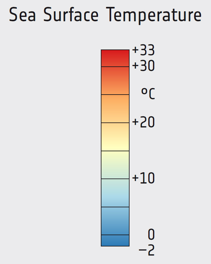
- Satellite Map:
- Look at the satellite images from January and July and try to identify differences.
- When and where can you see the highest sea surface temperatures?
- When and where can you see the lowest sea surface temperatures? Note that due to its salt content sea water freezes not at 0 °C, but a bit lower. Where in the maps would you expect sea ice? Hint: focus on the homogeneous blue regions in higher latitudes with a temperature of about -2 °C.
- Try to quantify the temperatures in the Gulf of Mexico and the Carribean Sea in January and in July.
- Try to follow the course of the North Atlantic Current from the US East coast to north west Europe. Note the eddies along its path.
Links
| Downloads: | |
|
PDF document of the case study (includes exercises): English, German, French, Italian, Spanish |
|
|
|
This case study is covered on pages 34-35 of the printed ESA Schoolatlas – download the PDF document of the page: English, German, French, Italian, Spanish |
| Links: |
|