
Superbloom in California
California’s superblooms are a very special phenomenon related to the distribution of biomass on land. They are rare and spectacular natural events in which vast expanses of desert and grasslands burst into vibrant displays of wildflowers. These blooms occur when the region experiences an unusually wet winter, allowing dormant wildflower seeds to germinate and grow in massive numbers. California’s deserts, such as Anza-Borrego, Antelope Valley, and Carrizo Plain, are particularly famous for superblooms, which feature flowers like poppies, lupines, and desert sunflowers.
The superbloom of 2023 near Lancaster, specifically in Antelope Valley, was one of the most striking in recent years. Following the heavy winter rains from atmospheric rivers and an unusually wet season, the Antelope Valley California Poppy Reserve saw a dense bloom of California poppies, the state’s iconic flower. The bloom attracted thousands of visitors, turning the landscape into a sea of bright orange flowers.
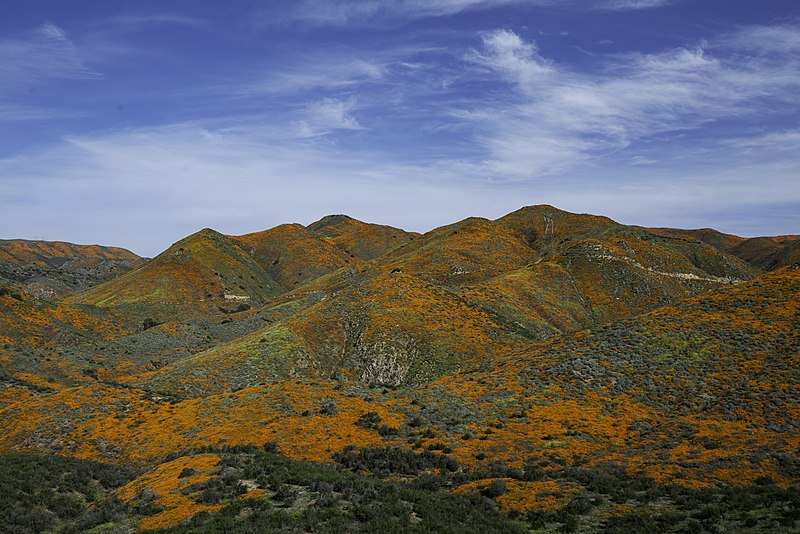
View of a superbloom event in California (photograph: John Fowler)
Data from satellites like Sentinel-2 and Landsat, which provide high-resolution imagery, help scientists track vegetation growth, soil moisture, and seasonal patterns that contribute to the blooms. These satellites can capture the extent and density of superblooms, offering valuable data on how climate factors like precipitation and temperature affect these phenomena.
Exercises
- Satellite Map:
- Look at the satellite image maps and try to identify agricultural land, built-up areas and solar power plants (hint: switch the satellite image layer off to verify your findings using the Open Streetmap layer).
- Click on the layer selector in the upper right and select the Sentinel-2 image from 2023-04-08.
- Which differences can you identify?
- Note the colourful regions, where the superbloom took place and compare with the other satellite image taken only 5 days later. What does this tell us about the duration of a superbloom event?
- Similar colour differences can be observed for agricultural land, too. Which agricultural products can you imagine will show this behaviour? Think about rape or tulips. Think about possibilities to use satellite data for monitoring crops.
- Copernicus Browser:
- Open the Copernicus Browser.
- Find the most recent Sentinel-2 dataset covering the area displayed in the satellite map.
- Select a true colour visualisation.
- Can you identify recent changes in the area (check e.g. agricultural land)?
- Select the false-colour infrared representation. Can you identify the land-use of the most intensely vegetated areas (represented by bright red colours)?
Links and Sources
| Downloads: | |
|
PDF document of the case study (includes exercises): English, German, French, Italian, Spanish |
|
|
|
This case study is covered on page 59 of the printed ESA Schoolatlas – download the PDF document of the page: English, German, French, Italian, Spanish |
| Links: |